Hike the Appalachian Trail Through the Smokies: The Ultimate Guide
By Korrin Bishop
The Appalachian Trail runs for over 2,190 miles from Georgia to Maine. While there are several section hikes to choose from for those not looking to thru-hike it, the stretch through Great Smoky Mountains National Park is a bucket list item for many.
I was lucky enough to hike this incredible stretch of trail with two of my dearest friends as part of what has become a tradition of choosing to endure physical suffering for my birthday. Before the hike, my two friends hadn’t met each other, but I knew the pairing would be perfect. And, on a trail as unforgiving as the AT through the Smokies can be, having an abundance of confidence in and love for your companions ranks as high as well-fitting hiking shoes, in my opinion.
By the time the three of us finished the AT through the Smokies, I can only say that I loved these two women more than ever and I will cherish those miles together for the rest of my life. Even though some were really dang hard.
If you’re looking to hike the AT through the Smokies, below, you’ll find a comprehensive guide to jumpstart your planning, including:
- Overview of the AT Through the Smokies
- How Many Days to Plan for Hiking the AT Through the Smokies
- Trailhead Parking and Shuttles for Hiking the AT Through the Smokies
- Where to Camp on the AT in the Smokies
- AT Water Sources in the Smokies
- Points of Interest Along the AT Through the Smokies
- Other Tips About Hiking the AT Through the Smokies
- Best Gear for Hiking the AT Through the Smokies
- Additional Smokies Articles From the Light Feet Blog
My hope with this blog is that you, too, can hike the AT through the Smokies and solidify your bonds with loved ones along the way, meet new faces that become a part of your lifelong story, or simply heal whatever needs healed on the way.

Overview of the AT Through the Smokies
The AT runs through Great Smoky Mountains National park for about 72 miles, largely hugging the Tennessee–North Carolina state line. Hiking northbound, the trail enters the Smokies at Fontana Dam and exits at Davenport Gap, not far from Interstate 40. Near the midpoint of the section, hikers cross Highway 441—also known as Newfound Gap Road—which is the main scenic thoroughfare through the heart of the park.
Hiking the AT through the Smokies is a classic example of what I somewhat lovingly and somewhat disdainfully refer to as the “Smoky Mountain Roll.” There are brutal climbs and knee-terrorizing descents, and they happen in frequent intervals. A good pair of trekking poles is highly recommended.
Cumulatively, the climb from Fontana Dam to Davenport Gap is around 20,000 feet. This is a good resource for seeing the elevation profile of the AT through the Smokies, including what your day’s hike will look like between shelters.
Regardless of which direction you enter the park from, you’ll be faced with a steep climb to start your trek. In my personal opinion, the section from Fontana Dam to Newfound Gap is the more challenging stretch that, at times, will make you question your life choices. But after hiking nearly all of the trails in Great Smoky Mountains National Park, it’s also home to some of my most favorite stretches of trail. Go figure.

How Many Days to Plan for Hiking the AT Through the Smokies
Most people plan for 7 to 8 days to backpack the full section of the AT through the Smokies. However, you can break up the sections at Newfound Gap and hike either in 3 to 5 days. You can also use Newfound Gap as a resupply point, as this road has easy access into Gatlinburg on the Tennessee side or Cherokee on the North Carolina side.
If you’re wondering how many days to plan for, I highly recommend leaning toward more days than fewer. Those Smoky Mountain rolls can really wear on you and slow you down, and extra time means a greater ability to truly enjoy the beauty around you.
My friends and I had originally planned to hike the full section in six days. On day three, we decided to switch up our plans and used the full six days to hike just the section from Fontana Dam to Newfound Gap instead. It allowed for a much more enjoyable trip. The next year, we returned and went from Davenport Gap to Newfound Gap in four days. We enjoyed taking our time and exploring the different shelters along the way.

Trailhead Parking and Shuttles for Hiking the AT Through the Smokies
If you’re planning to leave a car at either end of the trail, there is a decent amount of parking in a gravel lot on the Fontana Dam side. On the Davenport Gap side, there’s a small pull-off on the side of the road that can fit a few cars; otherwise, you can park down at the Big Creek Campground and hike up to the trailhead, which is another mile or two, depending on where you park. If you’re only hiking half of the park at a time, you can also choose to leave a car at Newfound Gap, which has a large paved parking area in a less remote area of the park.
I’ve left my car at Newfound Gap before without problems, but I don’t recommend leaving a car at the Fontana Dam or Davenport Gap trailheads overnight unless you must. Both trailhead areas have been hot spots for catalytic converter thefts over the past few years, which would be a huge bummer coming off of a long hike.
If you don’t have someone who can drop you off or pick you up at the trailheads, there are several shuttle services available in the surrounding towns on both the North Carolina and Tennessee sides that can help.
One service I can personally recommend is A Walk in the Woods based out of Gatlinburg. I’ve used them before and they’ve been professional, timely, and lovely people. Other authorized shuttle providers are listed on the park's website.

Where to Camp on the AT in the Smokies
Backpackers are required to stay at designated shelters or campsites when in Great Smoky Mountains National Park. You can reserve your spot by applying for a permit through the park’s online system or by calling the backcountry office at: 865-436-1297. There is a nominal fee per person per night that helps to support the park.
Pre-pandemic, backpackers were required to sleep on the bunks in the shelters along the AT rather than setting up a tent. However, the park allowed for tent camping during COVID-19 and, as of this writing (10/19/2022), still allows for backpackers to tent outside the shelter if they have a valid permit. If you have questions, contact the backcountry office to confirm any changes.
If tenting outside the shelter, do your best to leave no trace. In the past couple of years, I’ve unfortunately seen several people tenting outside the shelter stomp down vegetation to create new camping spots. These are heavily used areas and need everyone’s help to protect them.
Below is a list of the available campsites along the AT in the Smokies, starting from Fontana Dam and moving toward Davenport Gap. Distances between sites vary between around four to ten miles. With the exception of Site 113, all are sites that have a wooden bunk shelter.
- Site 113–Birch Spring Gap
- Mollies Ridge
- Russell Field
- Spence Field
- Derrick Knob
- Silers Bald
- Double Spring Gap
- Mount Collins
- Icewater Spring
- Pecks Corner
- Tricorner Knob
- Cosby Knob
- Davenport Gap
Several of the shelters have a moldering privy. If there is one, please use it to help protect these sites. And for the love of our backcountry rangers who have to clean them, please don’t put any garbage or really anything other than poop, pee, and toilet paper in them. Yes, that means no baby wipes. Pack that other stuff out.
Not all sites have privies, however, so make sure to bring along a trowel and follow proper backcountry pooping etiquette. The sites without privies will often have a wooden sign that points in the direction of the water source and the direction for where you should poop. For everyone’s sake, please pay attention to the signs.

AT Water Sources in the Smokies
All campsites along the AT in the Smokies have a pretty reliable water source that is typically marked with a sign if it’s not already obvious. If you’re worried about water levels, call the backcountry office for the latest information to ensure the springs are still running. You can also ask in groups like Hiking the Smokies, which have an active user base where someone has likely been out there very recently.
The A.T. Guide: A Handbook for Hiking the Appalachian Trail by David “Awol” Millers is another good resource for water sources along the trail. There are a few in between shelters, though not a ton, so be mindful of your supply throughout your hike.
All water along the trail should be boiled for at least a minute or filtered.

Points of Interest Along the AT Through the Smokies
I remember being on a hike in the Smokies one day and running into a couple visitors from out of town. They stopped me and asked, “Is there going to be a view on this trail?”
Especially if you’re hiking in the summer, a lot of Smoky Mountain hiking is under dense tree canopies. Even when you’re on a ridgeline, you’re not always going to have scenic vistas. But the Smokies are also the most biodiverse unit in the National Park Service, so it’s worth paying attention to all the little details you’re sure to pass along the way—from plants and fungi to insects and birds.
In addition to all those “hidden” wonders, there are several points of interest worth savoring along the way, such as those below.

Shuckstack Fire Tower
Roughly 3.5 miles northbound from the trailhead at Fontana Dam, you’ll reach an unmarked spur trail on your right, while the AT continues to your left. That spur trail leads to Shuckstack Fire Tower. There’s a good chance you’ll see that spur trail after the climb you just did, say “screw it,” and keep on hiking to camp. We definitely did. It wasn’t until a future backpacking trip that I actually decided to stop there, and I’m so glad I did.
Shuckstack Fire Tower—for those willing to carefully brave the rickety climb up the old metal fire tower’s stairs—offers some of the best views in the park, in my humble opinion. Plus, there’s something satisfying about being able to look down and see Fontana Lake where you started out so fresh and full of vigor, only to be taunted relentlessly by about a 2,400 vertical foot climb from the dam.

Rocky Top
About a mile past the Spence Field shelter heading northbound, you’ll find Rocky Top. It’s not marked by a sign, but you’ll know you’re there. On a clear day, you can catch views all the way down to Fontana Lake. It’s a beautiful rocky knob worth a well-deserved lunch break after the climb it takes to get there. I recommend singing “Rocky Top” while you’re up there before settling into some good backcountry silence.

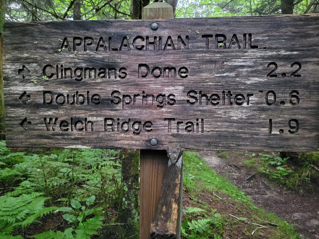
Clingmans Dome
Between the Double Spring Gap and Mount Collins shelters, you’ll reach Clingmans Dome. This is the highest point on the entire AT at 6,643 feet, as well as the highest point in Tennessee. You can take a quick spur trail to hike up a concrete observation tower for what can either be great view or nothing but fog. If you haven’t seen many people in a while, be prepared to, as this is a popular destination for day trips to the park.

Charlies Bunion
Another great overlook, Charlies Bunion is about a mile past Icewater Spring shelter heading northbound. It can get a little busy on weekends with day hikers, but if you make friends with a local, perhaps they’ll let you in on the secret spot. Charlies Bunion is a great place to sit on the big rocks for a while and enjoy the view, which can change quickly and frequently with the rolling fog.

Mount Cammerer
Between the Cosby Knob and Davenport Gap shelters, you’ll find a spur trail called the Mount Cammerer Trail. This is a 0.6-mile trail, so 1.2 miles extra roundtrip. At its end, you’ll find a fire tower unlike others in the park. Built by the Civilian Conservation Corp in the late 1930s, it was fully restored in 1995.
Considered a “western” style fire tower, the octagonal structure is enclosed with windows on all sides and a wraparound porch. The bottom is constructed with hand-cut stones. It’s a beautiful structure that offers wonderful views of the Pigeon River Gorge on clear days and, in our case, much-needed shelter from hurricane rains on not-so-clear days.

Other Tips About Hiking the AT Through the Smokies
As you’re preparing your section hike of the AT through the Smokies, there are a few other things to consider.
Weather
As with any trip, make sure to check the weather forecast for the days you’ll be out, as well as the few days before and after, and plan accordingly. Note that checking the weather forecast for the surrounding towns is often deceiving, as temperatures can be around 20 degrees cooler at Newfound Gap, for instance, than down in Gatlinburg.
I’ve had many experiences where there has been cold rain hammering on me at Clingmans Dome and by the time I get back to town, it’s a sweltering 90 degrees. Check weather forecasts for spots like Clingmans Dome, Newfound Gap, and other points along the trail for a more accurate picture.
Bears
Great Smoky Mountains National Park has a healthy black bear population, and, given an increase in tourism and visitors not familiar with proper bear etiquette, is also prone to some problem bears. Make sure to hang all of your smelly things at night. Each campsite in the Smokies has incredibly handy bear cables. Throw your stuff in a dry bag, attach it to the cable’s hook, pull, latch to the tree, and you’re good to go.
I don’t personally hike with bear spray unless I’m alone, but I do bring along a mini air horn and have indeed used it to move along some rather stubborn bears in the Smokies.
Shelter sites are prone to sudden closures due to bear activity. Do not ignore those closures. Plan ahead to identify alternative campsites should you end up with a closed site on your itinerary. The backcountry office will alert you to any closures via the contact information you provide on your permit application.
Check out BearWise and the park’s website for additional bear safety tips.
Maps
The AT through the Smokies is fairly well-marked, but you should still carry a map. The Great Smoky Mountains National Park maps by National Geographic are my go-to. And, if you purchase them through the Great Smoky Mountains Association, your purchase also helps protect the park for years to come.
The waterproof Great Smoky Mountains Trail Map is also handy for quick references, but shouldn’t be used for navigation purposes.
Best Gear for Hiking the AT Through the Smokies
I used my beloved Mariposa 60 backpack to hike the AT through the Smokies, and it performed like a champ, as always. It held all the food and gear I needed for several days and carried the weight well. Using a pack liner is key though, as the Smokies can be a very wet place.
Since I’m not the biggest fan of sleeping in the shelters, I also brought along The One tent and set it up with LT5 trekking poles, which also served to prolong the lifespan of my dear knees.

Section Hike the AT Through the Smokies for Scenic, Challenging Wonder
A hike along the AT through the Smokies is a grueling, but glorious experience that holds a special place in my heart. If you’re preparing for your own Smokies adventure, you might want to check out some of our other Smoky Mountain content on the Light Feet blog, as well as a few of our other resources:
- Nancy East and Chris Ford Set the Fastest Known Time for the Smokies 900
- Enjoy Spooky Season With These Smoky Mountain Haunts
- "Chasing the Smokies Moon" Is More Than the Story of Setting an FKT
- 45 miles. 11,000’ elevation gain. 24 hours. Meet the Tour de LeConte Challenge.
- 5 Trail Hacks for Beginner Thru-Hikers
- A Thru-Hiker's Guide to Toilet Paper Substitutes
And, as always, we’d love to see your adventures! Share your next Smoky Mountain jaunt with us by tagging us on social media (@gossamergear) and using the hashtag #takelessdomore.
---
Korrin Bishop is a freelance writer and editor with work published in Sierra, U.S. News & World Report, Southern Living, and Fodor's Travel, among others. Her writing focuses on outdoor adventure, environmental issues, travel, and nonprofits. Learn more about her writing and editing services at korrinbishop.com.