
Peak Bagging in the Weminuche Wilderness with the Kumo 36 Superlight Backpack
Passions come in waves for me; I get washed up in obsession, only to see that excitement subside when newer, shinier desires appear. This has been a cycle my whole life in the outdoors. I got fixated on multi-week backpacks, only for that to be overtaken by the thrill of climbing high peaks. Then I dreamed of thru-hiking the long trails. When I was nearly complete with the triple crown, I climbed the Grand Teton, and my focus again shifted to mountaineering, this time more technical peaks. This past year, I've begun to combine my two passions: pushing three- to six-day trips that mesh those long days in the backcountry that you get while thru-hiking with technical ascents, which add excitement, learning, and growth. I call these "Mini-Epics."

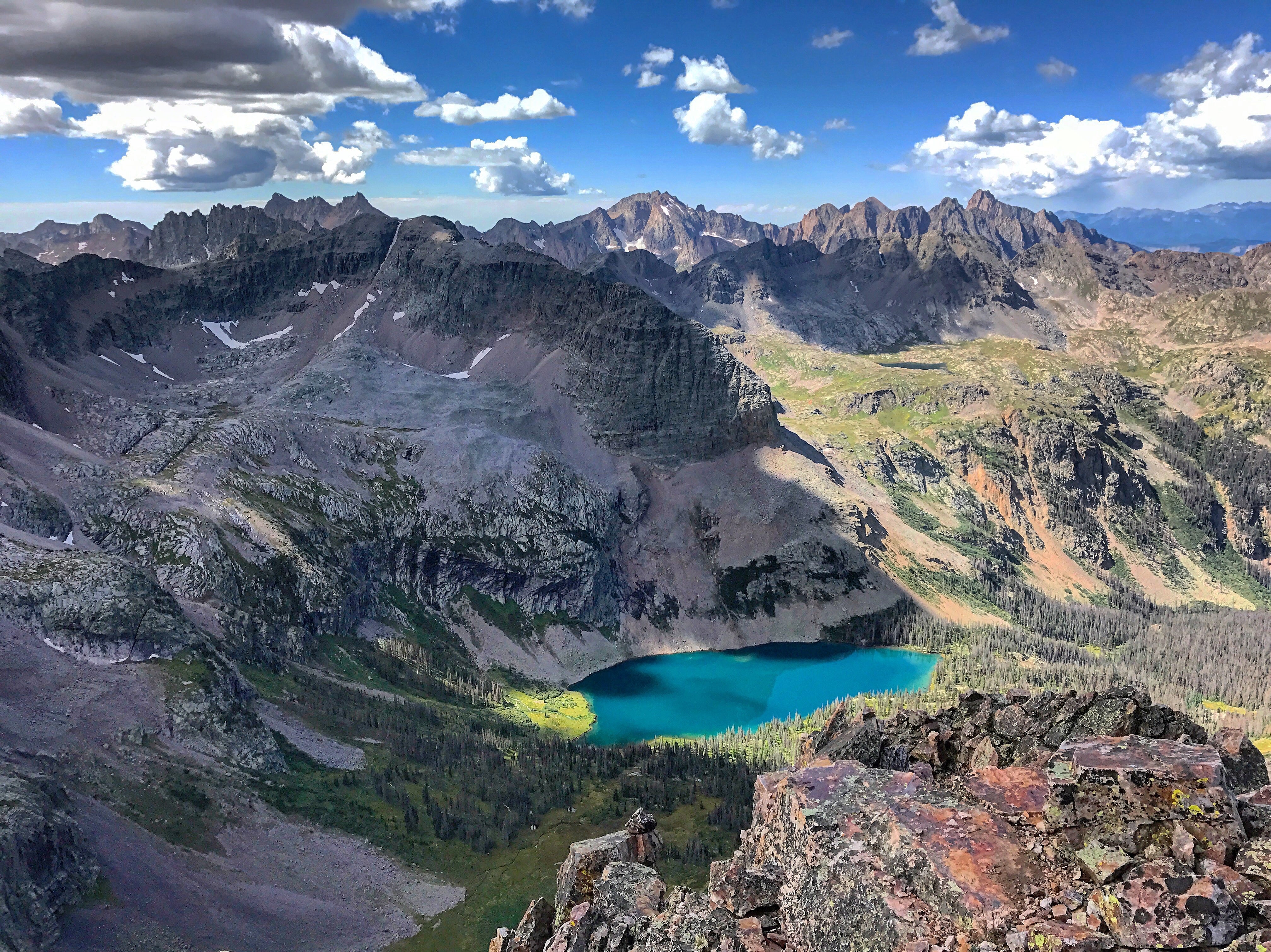
My most recent venture brought me to the Weminuche Wilderness of Colorado. At just shy of 500,000 acres, it is the largest Wilderness Area in Colorado. This area caught my eyes ten years ago while hiking the Highland Mary Lakes Loop outside of Silverton. Across the valley, large quartzite slabs lift in a wave-like pattern, forming towering peaks with solid north-facing walls. Inspiring and intimidating, these peaks will draw you in!
For this adventure, I focused on two difficult-to-reach sub-regions of the Weminuche; the Grenadier Range and the Needles Range. We would be attempting several class 3 and 4 peaks, as well as two airy, low 5th class routes. Due to this, the planning for the trip required more than the standard backpacking kit. In addition to the traditional kit, I also had to have the following gear items:
- 30m rope
- Harness
- Climbing Helmet
- Locking Carabiners (2)
- Belay device
- 3 small CAM's

Two of my good friends, Andy and Juddson, joined me. I hiked most of the CDT with Andy in 2015. He's a sharp kid with a strong wall climbing background. He's fearless and bold, but knows when to take the proper precautions. He's also blazingly fast (current John Muir Trail unsupported Fastest Known Time record holder) and seems to never slow, making him the perfect candidate to haul the rope the entire trip! Juddson is a fellow Colorado peakbagger, also looking to climb the 100 highest summits in the state. He's young, in a great shape, and has a strong desire to get to the tippy-tops of tall piles of rocks. We're wired the same. He's also full of positive energy, which is a key to success in the backcountry.
After meeting around midnight at Molas Pass, we slept through heavy rain, waking up at 4am. In the dark of night, the Colorado Trail led us down to the Animas River. After crossing the river and the railroad tracks, the trail heads up Elk Creek and into the Weminuche. From small reflecting ponds, we left the trail and headed up a faint social trail to the heart of Vestal Basin. We quickly set up camp under a pocket of pines and packed for Vestal's iconic Wham Ridge. A near-vertical slab of intact quartz bedrock offers not only a beautiful setting, but rare solid rock for an aesthetic climb at 12,000 feet above sea level. We worked our way up, easing into the increasingly steep face via a series of small shelves before reaching the crux of the route. We eyed the crack in the wall (the 5.4 crux of the route), and Andy decided to take the lead without the rope, and set up protection if Juddson or I desired.


With no hesitation, Andy was quickly 30 feet above us, moving quickly on the exposed face. Juddson and I soon followed, going one at a time to avoid any small rockfall. A few hundred feet later, the three of us were on the summit of Vestal Peak. We had no time to celebrate, as storm clouds were building in the West. We descended the crumbly choss fest on the south side of the slope in haste. We had hoped to climb Vestal's lower neighbor to the west, Arrow Peak. However, the rain rolled in, and the rock was far too slick for a safe attempt. It was back to the tents for the evening, catching up on sleep.

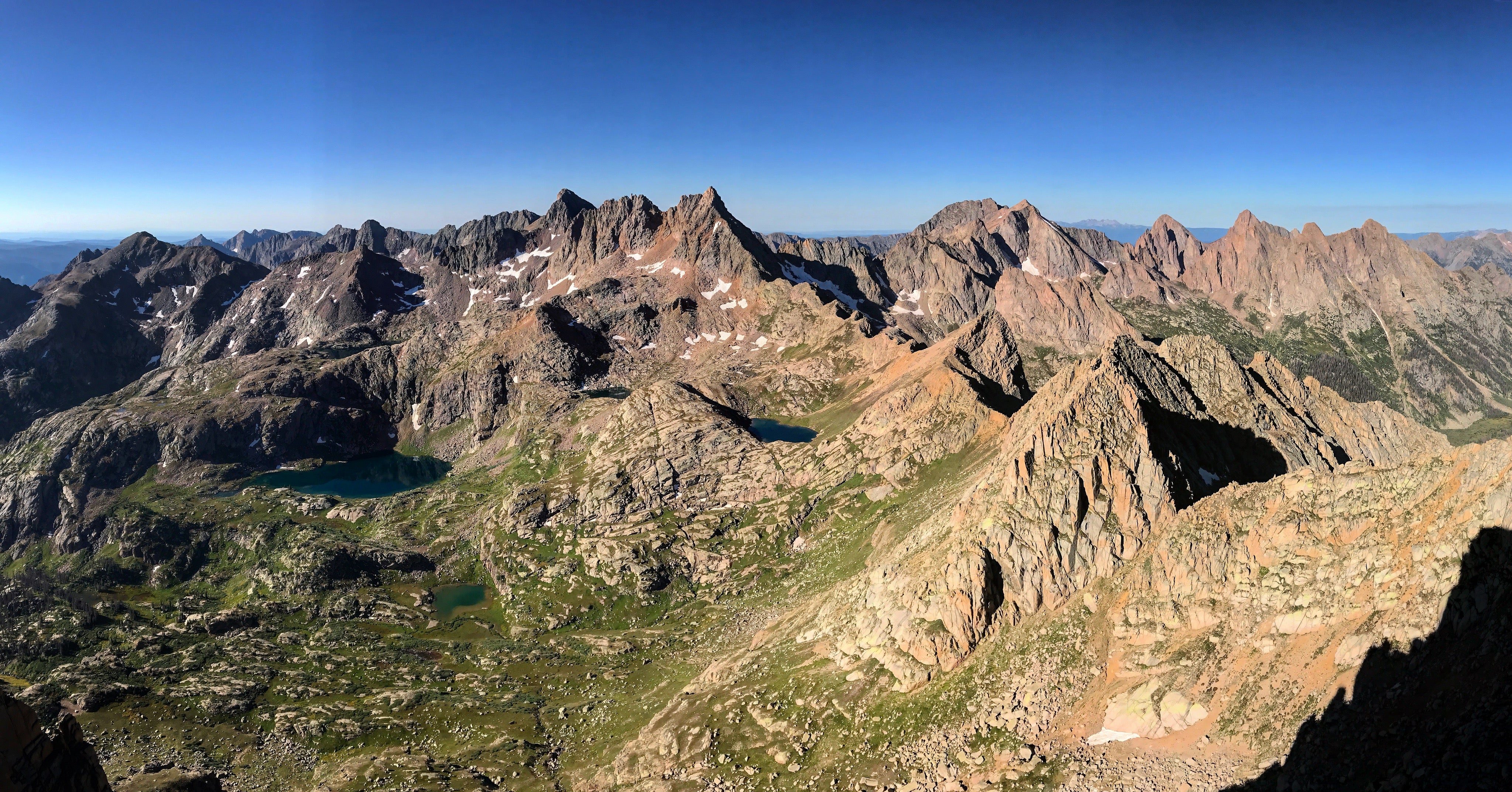
The following morning, we broke camp and set out for an unnamed pass between Vestal and West Trinity Peak. I dropped most of my gear at the pass, hung our food from the rocks, and began the Trinity Traverse. The three Trinity Mountains shared the same quartzite bedrock uplift as Vestal and Arrow, all ranked summits above 13,745 feet. The traverse stays on the ridge line with continuous class 3 and 4 terrain. These three peaks are often overlooked due to Wham Ridge on Vestal, but this should not be the case!

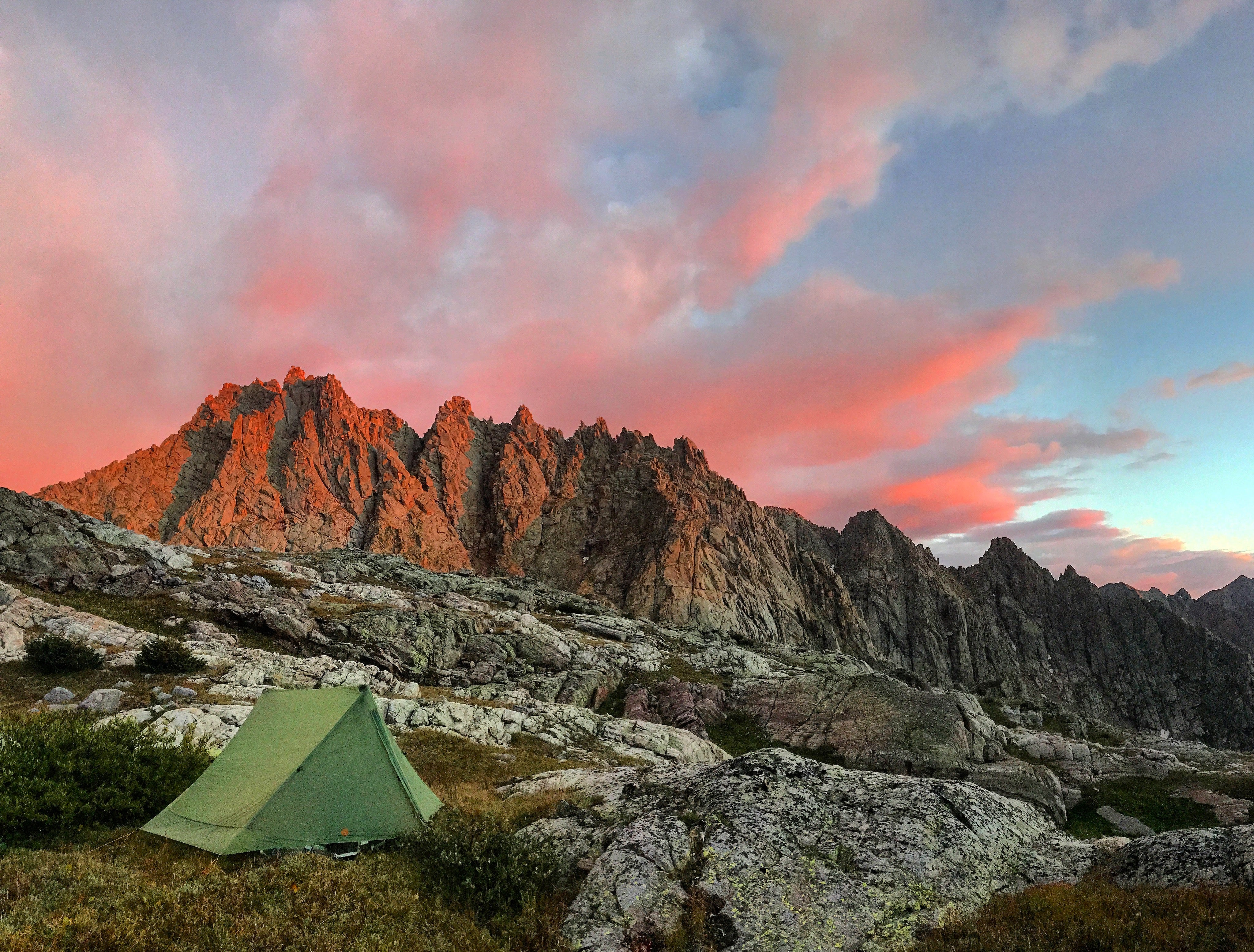
After completing the long traverse, we had to ascend back to the saddle to retrieve our gear before dropping over a thousand feet, following faint game trails to the glacial blue Balsam Lake. Andy made his best attempt at fishing (it was still very poor, without a single bite) before backpacking up and over another tall pass between Peaks 5 and 6. We had hoped to climb Peak 6, as we were only 1,000 feet from the summit. However, an electrical storm had us moving down and setting up camp in a more sheltered location. For the second day in a row, weather foiled our grandiose plans. This is the norm in these parts, as the high plateau causes a vortex of electricity, rain, hail, and high winds.


On the third day, our plan was to get Jagged peak, and hike over Ruby Pass and camp in Ruby Basin. Jagged Peak is known in the Colorado mountaineering community as the best climb in the state due to its sharp granite rock, remoteness, and classic standard route running at low 5th class. Well before dawn, we left our camp at No Name Lake and made the cold bushwhack to Jagged Pass. From there, we eyed the route on the north face of the mountain.
Soon, the sun rose above Rio Grande Pyramid to the East, and we began picking our way through the 4th class terrain, only to be surprised by a mountain goat high across a little nook, not more than 15 yards from us. We must have startled it, as it shot across the very narrow ledge, defying gravity and making seemingly impossible moves look easy. Those guys are kings of this terrain. After some tricky route finding, we nearly circled the summit, starting on the north side and reaching the top from the south slopes due to Jagged Mountains' Tetris-like maze of a summit.

Once on top we were welcomed to the most expansive summit view I've had–mountains in all directions as far as you can see. I felt as though I was in the very heart of Colorado. I've been on summits all over the U.S. and Canada, yet this summit was distinctly different than any other. There were no huge valleys, nor any signs of civilization or human impact. Thirteen- and fourteen-thousand-foot peaks reigned as far as you could see in all directions. To get to the nearest dirt two-track would take over a day from here for most people. A paved road even longer. There's no place in the lower 48 that has more vast mountains than this summit! It was an inspiring occasion, and we were #blessed with blue skies and a light breeze.
The climb down included a pitch we decided to rappel from rather than downclimb. Andy blew right by it with the rope… kids these days. Juddson and I called down to him, and he came back up and we set up an anchor to rappel from. A short scree ski off the saddle and we were back to our camp at No Name Lake to break down and keep heading down No Name basin toward the Animas. Halfway to the Animas, we cut south on a finger of No Name basin, and bushwhacked over toward Ruby Pass. Once on the pass, we had a clear view down to the basin with Turret Peak and Pigeon Peak shooting sharply above the basin. The saddle between the two peaks was not far. However, it involved going down nearly 2,000 feet and then back up another 2,500. We eyed it, checked the time, and decided to make a push for them that day rather than saving the peaks for the following morning.
Andy ran down the pass. Seriously, he was running. Like a wild animal, arms flailing down the steep, loose slope. There was a grouping of mountain goats down below. Juddson and I were dying laughing as we watched Andy bull rush the heard, unknowingly. When he got within 20 or so yards, they scattered up the slopes and away. When we finally caught up to him, he had no idea there were any goats. Too focused on not breaking a leg, I guess!


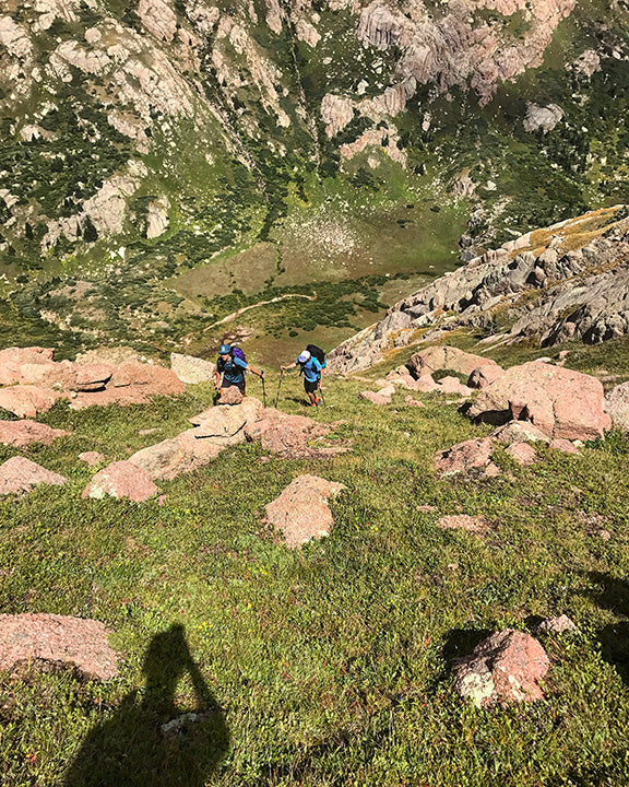

We had to hustle if we were going to make the summits of Turret and Pigeon before daylight, and we were going to have to get lucky with weather–but things were looking good! After a long, steep climb to the saddle, we dropped our bags and headed towards Turret Peak, one of Colorado's 100 highest peaks. Grapple started falling just before we reached the summit, but the weather further west didn't look too intimidating. We dropped over a thousand feet back to the saddle with Pigeon and picked up our bags. We dropped another fifteen-hundred feet, skirting around from the east side of Pigeon to the west side. Before starting to ascend to Pigeon, we again dropped our packs, put a few snacks in the pockets, and made our way up a steep slope with no trail.
After over 6,500 feet of gain already that day, we were so excited to get Pigeon that we barely noticed the tired legs and made the summit in short order. It's rare to be on a remote summit at 6:30pm, but that's when we reached the top. The lighting was perfect, and we could see Jagged Peak far in the distance, as well as the Vestal Group. It seemed unreal that we had traveled so far in just a few days. We never moved faster than three and a half miles an hour, but if you just keep at it, you can really cover some ground. In addition to the seven summits we got, Juddson and I looked out and were naming even more summits we wished to return to (Animas, Monitor, Vallecito, Leviathan, Storm King, and many, many more). That's typically how it works out here. Go get all the mountains you've been planning, only to add more to your list. It just keeps growing and growing!

After a good time on the summit we hurried off, descending towards the Animas River as the sun beamed rays through the valley. We made it to camp in an unnamed hanging basin just after dark. We set up camp and laid outside the tent as the stars began to show, reminiscing about the best parts of the day.

The following morning, we pushed through a dense forest with no trail, towards the Animas. After several thousand feet, we reached a trail along the Animas that leads up to Ruby Basin from Needleton. We took it south along the Animas River to the Needleton stop on the Durango to Silverton Narrow Gauge Railroad. Several hikers were camped up waiting for the train to take them from this remote location back to Durango. They likely did the Chicago Basin 14ers, another great little trip. It was a cruise back to the Elk Meadows stop, and then back up to Molas Pass. We had huge burgers at Maggie's Kitchen in Ouray before we parted ways; Andy heading back to Provo, and Juddson and I going east to Golden.In all, we were only out in the Weminuche for just over three days, yet we climbed seven of Colorado's highest and most remote summits with several exhilarating technical sections, and over 50 miles of backpacking, most with no trail at all.
Yet, even with the technical gear and backpacking gear, I only needed one pack while in the Weminuche–The Kumo. It fit everything comfortably while backpacking (I even carried the rope some of the time), and is small and durable enough to take on the technical peaks without getting in the way. The Kumo is perfect for "Mini-Epics."
Check out the video below to see what gear I carry in it!